Mock sample for your project: Miataru API

Integrate with "Miataru API" from miataru.com in no time with Mockoon's ready to use mock sample
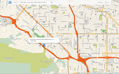
Version: 1.0.0


Use this API in your project

Integrate third-party APIs faster by using "Miataru API" ready-to-use mock sample. Mocking this API will allow you to start working in no time. No more accounts to create, API keys to provision, accesses to configure, unplanned downtime, just work.
Improve your integration tests by mocking third-party APIs and cover more edge cases: slow response time, random failures, etc.

Description

The Miataru API is very simple and straight forward. Generally you're posting (HTTP POST) a JSON formatted request to a service method locations and you get back a JSON formatted answer. Please take into consideration that this has the request-for-comment status and that it can change while there's work done on client and server applications. Versioning therefore is done by prepending the version number - /v1/ for version 1 - to the method call.

Other APIs in the same category

HERE Network Positioning API v2

here.com
Positioning API accepts requests with radio network measurements and replies with corresponding location estimate. For more details and examples, see Developer's Guide. Cellular measurements are given in terms defined in 3GPP and 3GGP2 specifications, see the corresponsing documentation at http://www.3gpp.org.
Breaking changes from v1:
JSON fields
altaccuracy, baselat, baselng, cellparams, pilotpower, pnoffset, powrx, rxlevel,
have been deprecated and replaced with
altAccuracy, baseLat, baseLng, cellParams, pilotPower, pnOffset, rss, rxLevel
respectively.
Dependent parameters combined as a subobject.
CDMA, GSM, WCDMA, TD-SCDMA and LTE local identification parameters for serving cell moved under localId property.
GSM neighbor global ID: lac and cid for neighbor cell moved under globalIdentity property.

bng2latlong

Convert an OSGB36 easting and northing (British National Grid) to WGS84 latitude and longitude.

Gravity API

amentum.space
The gravitational field of the earth is non-uniform. The geoid is the shape the
ocean surface would take if only gravity and the rotation of the Earth
were considered. The geoid is the surface that defines zero elevation.
The geoid height is the difference between an ideal reference ellipsoid and the geoid.
The gravity anomaly is the difference between the acceleration due to gravity on the Earth's surface and the value calculated assuming the reference ellipsoid.
The official Earth Gravitational Model EGM2008 was developed and released to the public by the National Geospatial-Intelligence Agency (NGA).
Our EGM2008 API provides on-demand access to the EGM2008 model, as implemented by the open-source GeographicLib Gravity library.
API requests must contain a key "API-Key" in the header (see code samples). Obtain a key from here.
Amentum Pty Ltd is not responsible nor liable for any loss or damage of any sort incurred as a result of using the API.
Copyright Amentum Pty Ltd 2021.

The Water Linked Underwater GPS API

waterlinked.com
API for the Water Linked Underwater GPS. For more details: http://www.waterlinked.com
Recommended approach for connecting to a Underwater GPS via the API is:
If "GET /api/" times out, the Underwater GPS is not running (on this IP address)
If "GET /api/" responds with 200 OK check that the api version returrned (eg "v1") is supported by the client (eg: also supports "v1").
If the api version returned does not match what the client supports: give an error to the user and recommend upgrading. (Eg: response is "v2" while client only supports "v1")
If "GET /api/" responds with 301 Moved permanently. "GET /api/v1/version" to check if the kit has a version earlier than 1.5.
"GET /api/v1/version" will always respond with 200 OK on Underwater GPS earlier than 1.5 release.
Configuration API is is not considered stable and will potentially be changed

Daymet Single Pixel Extraction Tool API

ornl.gov
Welcome to the Daymet Single Pixel Extraction Tool API. You can use this API to download daily surface data within the Daymet database in a csv or json format for a single point. This API allows users to query a single geographic point by latitude and longitude in decimal degrees. A routine is executed that translates the (lon, lat) coordinates into projected Daymet (x,y) Lambert Conformal Coordinates. These coordinates are used to access the Daymet database of daily interpolated surface weather variables. Daily data from the nearest 1 km x 1 km Daymet grid cell are extracted from the database.
If you would like to learn how to automate the download of multiple locations for the Daymet Single Pixel Extraction Tool, click here.

Quicksold REST API

Maps

tomtom.com
The Maps API web services suite offers the following APIs:
Raster
The Maps Raster API renders map data that is divided into gridded sections called tiles. Tiles are square images (png or jpg format) in various sizes which are available at 19 different zoom levels, ranging from 0 to 20. For zoom level 0, the entire earth is displayed on one single tile, while at zoom level 20, the world is divided into 2 40 tiles.
Vector
Similar to Maps Raster API, the Maps Vector API serves data on different zoom level ranging from 0 to 22. For zoom level 0, the entire earth is displayed on one single tile, while at zoom level 22, the world is divided into 2 44 tiles.
The Maps Vector Service delivers geographic map data packaged in a vector representation of squared sections called vector tiles. Each tile includes pre-defined collections of map features (points, lines, road shapes, water polygons, building footprints, ect.) delivered in one of the specified vector formats. Format of the tile is formally described using protobuf schema.

IdealPostcodes API

ideal-postcodes.co.uk
Open API spec for Ideal Postcodes API (api.ideal-postcodes.co.uk)

TrapStreet API

trapstreet.com
The TrapStreet API finds trap streets in Google Maps, Bing Maps and OpenStreetMap data.

Dados Abertos - API

inpe.br
API de Dados Abertos com dados processados pelo grupo de monitoramento de Queimadas do INPE.

uebermaps API endpoints

uebermaps.com
Enable people to store spots on public and private maps
Drive your app to success with Lyft's API