Mock sample for your project: HERE Tracking API
Integrate with "HERE Tracking API" from here.com in no time with Mockoon's ready to use mock sample
HERE Tracking
here.com
Version: 2.1.58
Integrate third-party APIs faster by using "HERE Tracking API" ready-to-use mock sample. Mocking this API will allow you to start working in no time. No more accounts to create, API keys to provision, accesses to configure, unplanned downtime, just work.
Improve your integration tests by mocking third-party APIs and cover more edge cases: slow response time, random failures, etc.
Description
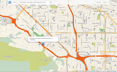
HERE Tracking is a cloud product designed to address location tracking problems for a wide range of Location IoT industry verticals.
HERE Tracking also includes end-user mobile and web applications that can be used to demonstrate the product.
Other APIs by here.com

HERE Network Positioning API v2
here.com
Positioning API accepts requests with radio network measurements and replies with corresponding location estimate. For more details and examples, see Developer's Guide. Cellular measurements are given in terms defined in 3GPP and 3GGP2 specifications, see the corresponsing documentation at http://www.3gpp.org.
Breaking changes from v1:
JSON fields
altaccuracy, baselat, baselng, cellparams, pilotpower, pnoffset, powrx, rxlevel,
have been deprecated and replaced with
altAccuracy, baseLat, baseLng, cellParams, pilotPower, pnOffset, rss, rxLevel
respectively.
Dependent parameters combined as a subobject.
CDMA, GSM, WCDMA, TD-SCDMA and LTE local identification parameters for serving cell moved under localId property.
GSM neighbor global ID: lac and cid for neighbor cell moved under globalIdentity property.
Other APIs in the same category
TrapStreet API
trapstreet.com
The TrapStreet API finds trap streets in Google Maps, Bing Maps and OpenStreetMap data.

GraphHopper Directions API
With the GraphHopper Directions API you can integrate A-to-B route planning, turn-by-turn navigation,
route optimization, isochrone calculations and other tools in your application.
The GraphHopper Directions API consists of the following RESTful web services:
Routing API,
Route Optimization API,
Isochrone API,
Map Matching API,
Matrix API,
Geocoding API and
Cluster API.
Explore our APIs
Get started
Sign up for GraphHopper
Create an API key
Each API part has its own documentation. Jump to the desired API part and learn about the API through the given examples and tutorials.
In addition, for each API there are specific sample requests that you can send via Insomnia or Postman to see what the requests and responses look like.
Insomnia
To explore our APIs with Insomnia, follow these steps:
Open Insomnia and Import our workspace.
Specify your API key in your workspace: Manage Environments -> "api_key": your API key
Start exploring
Insomnia
Postman
To explore our APIs with Postman, follow these steps:
Import our request collections as well as our environment file.
Specify your API key in your environment: "api_key": your API key
Start exploring
Postman
API Client Libraries
To speed up development and make coding easier, we offer the following client libraries:
JavaScript client - try the live examples
Others like C#, Ruby, PHP, Python, ... automatically created for the Route Optimization API
Bandwidth reduction
If you create your own client, make sure it supports http/2 and gzipped responses for best speed.
If you use the Matrix, the Route Optimization API or the Cluster API and want to solve large problems, we recommend you to reduce bandwidth
by compressing your POST request
and specifying the header as follows: Content-Encoding: gzip. This will also avoid the HTTP 413 error "Request Entity Too Large".
Contact Us
If you have problems or questions, please read the following information:
FAQ
Public forum
Contact us
GraphHopper Status Page
To stay informed about the latest developments, you can
follow us on twitter,
read our blog,
watch our documentation repository,
sign up for our newsletter or
our forum.
Select the channel you like the most.
Map Data and Routing Profiles
Currently, our main data source is OpenStreetMap. We also integrated other network data providers.
This chapter gives an overview about the options you have.
OpenStreetMap
Geographical Coverage
OpenStreetMap covers the whole world. If you want to see for yourself if we can provide data suitable for your region,
please visit GraphHopper Maps.
You can edit and modify OpenStreetMap data if you find that important information is missing, e.g. a weight limit for a bridge.
Here is a beginner's guide that shows how to add data. If you have edited data, we usually consider your data after 1 week at the latest.
Supported Vehicle Profiles
The Routing, Matrix and Route Optimization APIs support the following vehicle profiles:
Name | Description | Restrictions | Icon
-----------|:----------------------|:--------------------------|:---------------------------------------------------------
car | Car mode | car access | car image
small_truck| Small truck like a Mercedes Sprinter, Ford Transit or Iveco Daily | height=2.7m, width=2+0.4m, length=5.5m, weight=2080+1400 kg | small truck image
truck | Truck like a MAN or Mercedes-Benz Actros | height=3.7m, width=2.6+0.5m, length=12m, weight=13000 + 13000 kg, hgv=yes, 3 Axes | truck image
scooter | Moped mode | Fast inner city, often used for food delivery, is able to ignore certain bollards, maximum speed of roughly 50km/h | scooter image
foot | Pedestrian or walking without dangerous SAC-scales | foot access | foot image
hike | Pedestrian or walking with priority for more beautiful hiking tours and potentially a bit longer than foot. Walking duration is influenced by elevation differences. | foot access | hike image
bike | Trekking bike avoiding hills | bike access | bike image
mtb | Mountainbike | bike access | Mountainbike image
racingbike| Bike preferring roads | bike access | racingbike image
Please note:
all motor vehicles (car, smalltruck, truck and scooter) support turn restrictions via turncosts=true
the free package supports only the vehicle profiles car, bike or foot
up to 2 different vehicle profiles can be used in a single optimization request. The number of vehicles is unaffected and depends on your subscription.
we offer custom vehicle profiles with different properties, different speed profiles or different access options. To find out more about custom profiles, please contact us.
a sophisticated motorcycle profile is available up on request. It is powered by the Kurviger Routing API and favors curves and slopes while avoiding cities and highways.
TomTom
If you want to include traffic, you can purchase the TomTom Add-on.
This Add-on only uses TomTom's road network and historical traffic information.
Live traffic is not yet considered. If you are interested to learn how we consider traffic information, we recommend that you read this article.
Please note the following:
Currently we only offer this for our Route Optimization API.
In addition to our terms, you need to accept TomTom's End User License Aggreement.
We do not use TomTom's web services. We only use their data with our software.
Contact us for more details.
Geographical Coverage
We offer
Europe including Russia
North, Central and South America
Saudi Arabia
United Arab Emirates
South Africa
Australia
Supported Vehicle Profiles
Name | Description | Restrictions | Icon
-----------|:----------------------|:--------------------------|:---------------------------------------------------------
car | Car mode | car access | car image
small_truck| Small truck like a Mercedes Sprinter, Ford Transit or Iveco Daily | height=2.7m, width=2+0.4m, length=5.5m, weight=2080+1400 kg | small truck image

Visual Crossing Weather API
Weather Forecast and Historical Weather Observation Data via an convenient, restful API.
Gravity API
amentum.space
The gravitational field of the earth is non-uniform. The geoid is the shape the
ocean surface would take if only gravity and the rotation of the Earth
were considered. The geoid is the surface that defines zero elevation.
The geoid height is the difference between an ideal reference ellipsoid and the geoid.
The gravity anomaly is the difference between the acceleration due to gravity on the Earth's surface and the value calculated assuming the reference ellipsoid.
The official Earth Gravitational Model EGM2008 was developed and released to the public by the National Geospatial-Intelligence Agency (NGA).
Our EGM2008 API provides on-demand access to the EGM2008 model, as implemented by the open-source GeographicLib Gravity library.
API requests must contain a key "API-Key" in the header (see code samples). Obtain a key from here.
Amentum Pty Ltd is not responsible nor liable for any loss or damage of any sort incurred as a result of using the API.
Copyright Amentum Pty Ltd 2021.

IP geolocation API
Abstract IP geolocation API allows developers to retrieve the region, country and city behind any IP worldwide. The API covers the geolocation of IPv4 and IPv6 addresses in 180+ countries worldwide. Extra information can be retrieved like the currency, flag or language associated to an IP.
Space Radiation API
amentum.space
Space has a hostile radiation environment that increases the risk of cancers in humans and malfunctions in spacecraft electronics. The types of space radiation of primary concern are:
Galactic Cosmic Rays from outside our solar system generated by
supernovae and other phenomena;
Solar Energetic Particles produced by the Sun during intense and
sporadic bursts of activity; and
Trapped Radiation: energetic particles confined by Earth's magnetic
field, usually comprising an inner belt of mostly high energy protons
and an outer belt dominated by lower energy electrons and plasma.
Understanding the space radiation environment for a particular mission profile is becoming increasingly important. Commercial off-the-shelf electronic components that aren't resilient to space radiation are now prevalent. Longer duration missions to cislunar space, Mars, and beyond are placing astronauts at greater risk of radiation exposure.
API requests must contain a key "API-Key" in the header (see code samples). Obtain a key from here.
Help us improve the quality of our web APIs by completing our 2 minute survey here.
Amentum Pty Ltd is not responsible nor liable for any loss or damage of any sort incurred as a result of using the API.
Copyright Amentum Pty Ltd 2021.

IP2Location IP Geolocation
ip2location.com
IP2Location web service providing a service to do a reverse lookup of an IP address to an ISO3166 country code, region or state, city, latitude and longitude, ZIP/Postal code, time zone, Internet Service Provider (ISP) or company name, domain name, net speed, area code, weather station code, weather station name, mobile country code (MCC), mobile network code (MNC) and carrier brand, elevation, usage type, address type and IAB category. There are also 7 categories of additional add-on response fields supported such as metro, olson time zone, translations and more. Refer to https://www.ip2location.com/web-service/ip2location for further information.

Maps
tomtom.com
The Maps API web services suite offers the following APIs:
Raster
The Maps Raster API renders map data that is divided into gridded sections called tiles. Tiles are square images (png or jpg format) in various sizes which are available at 19 different zoom levels, ranging from 0 to 20. For zoom level 0, the entire earth is displayed on one single tile, while at zoom level 20, the world is divided into 2 40 tiles.
Vector
Similar to Maps Raster API, the Maps Vector API serves data on different zoom level ranging from 0 to 22. For zoom level 0, the entire earth is displayed on one single tile, while at zoom level 22, the world is divided into 2 44 tiles.
The Maps Vector Service delivers geographic map data packaged in a vector representation of squared sections called vector tiles. Each tile includes pre-defined collections of map features (points, lines, road shapes, water polygons, building footprints, ect.) delivered in one of the specified vector formats. Format of the tile is formally described using protobuf schema.
World Time API
worldtimeapi.org
A simple API to get the current time based on a request with a timezone.

Cloud-RF API
cloudrf.com
Use this JSON API to build and test radio links for any radio, anywhere. Authenticate with your API2.0 key in the request header as key
Miataru
The Miataru API is very simple and straight forward. Generally you're posting (HTTP POST) a JSON formatted request to a service method locations and you get back a JSON formatted answer. Please take into consideration that this has the request-for-comment status and that it can change while there's work done on client and server applications. Versioning therefore is done by prepending the version number - /v1/ for version 1 - to the method call.
