Mock sample for your project: uebermaps API endpoints
Integrate with "uebermaps API endpoints" from uebermaps.com in no time with Mockoon's ready to use mock sample

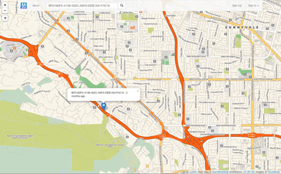
uebermaps API endpoints
uebermaps.com
Version: 2.0
Start working with "uebermaps API endpoints" right away by using this ready-to-use mock sample. API mocking can greatly speed up your application development by removing all the tedious tasks or issues: API key provisioning, account creation, unplanned downtime, etc.
It also helps reduce your dependency on third-party APIs and improves your integration tests' quality and reliability by accounting for random failures, slow response time, etc.
Description
Enable people to store spots on public and private maps
Other APIs in the same category


Weatherbit.io - Swagger UI Weather API documentation
weatherbit.io
This is the documentation for the Weatherbit Weather API. The base URL for the API is http://api.weatherbit.io/v2.0/ or https://api.weatherbit.io/v2.0/. Below is the Swagger UI documentation for the API. All API requests require the key parameter. An Example for a 5 day forecast for London, UK would be http://api.weatherbit.io/v2.0/forecast/3hourly?city=London&country=UK. See our Weather API description page for additional documentation.

IP2Location IP Geolocation
ip2location.com
IP2Location web service providing a service to do a reverse lookup of an IP address to an ISO3166 country code, region or state, city, latitude and longitude, ZIP/Postal code, time zone, Internet Service Provider (ISP) or company name, domain name, net speed, area code, weather station code, weather station name, mobile country code (MCC), mobile network code (MNC) and carrier brand, elevation, usage type, address type and IAB category. There are also 7 categories of additional add-on response fields supported such as metro, olson time zone, translations and more. Refer to https://www.ip2location.com/web-service/ip2location for further information.

Gravity API
amentum.space
The gravitational field of the earth is non-uniform. The geoid is the shape the
ocean surface would take if only gravity and the rotation of the Earth
were considered. The geoid is the surface that defines zero elevation.
The geoid height is the difference between an ideal reference ellipsoid and the geoid.
The gravity anomaly is the difference between the acceleration due to gravity on the Earth's surface and the value calculated assuming the reference ellipsoid.
The official Earth Gravitational Model EGM2008 was developed and released to the public by the National Geospatial-Intelligence Agency (NGA).
Our EGM2008 API provides on-demand access to the EGM2008 model, as implemented by the open-source GeographicLib Gravity library.
API requests must contain a key "API-Key" in the header (see code samples). Obtain a key from here.
Amentum Pty Ltd is not responsible nor liable for any loss or damage of any sort incurred as a result of using the API.
Copyright Amentum Pty Ltd 2021.
Miataru
The Miataru API is very simple and straight forward. Generally you're posting (HTTP POST) a JSON formatted request to a service method locations and you get back a JSON formatted answer. Please take into consideration that this has the request-for-comment status and that it can change while there's work done on client and server applications. Versioning therefore is done by prepending the version number - /v1/ for version 1 - to the method call.

Cloud-RF API
cloudrf.com
Use this JSON API to build and test radio links for any radio, anywhere. Authenticate with your API2.0 key in the request header as key
TransitFeeds API
API to view feed information and download feeds from TransitFeeds.com

Visual Crossing Weather API
Weather Forecast and Historical Weather Observation Data via an convenient, restful API.

HERE Network Positioning API v2
here.com
Positioning API accepts requests with radio network measurements and replies with corresponding location estimate. For more details and examples, see Developer's Guide. Cellular measurements are given in terms defined in 3GPP and 3GGP2 specifications, see the corresponsing documentation at http://www.3gpp.org.
Breaking changes from v1:
JSON fields
altaccuracy, baselat, baselng, cellparams, pilotpower, pnoffset, powrx, rxlevel,
have been deprecated and replaced with
altAccuracy, baseLat, baseLng, cellParams, pilotPower, pnOffset, rss, rxLevel
respectively.
Dependent parameters combined as a subobject.
CDMA, GSM, WCDMA, TD-SCDMA and LTE local identification parameters for serving cell moved under localId property.
GSM neighbor global ID: lac and cid for neighbor cell moved under globalIdentity property.
Enode API
enode.io
Download OpenAPI 3.0 Specification
Download Postman Collection
The Enode API is designed to make smart charging applications easy to develop. We provide an abstraction layer that reduces the complexity when extracting vehicle data and sending commands to vehicles from a variety of manufacturers.
The API has a RESTful architecture and utilizes OAuth2 authorization.
We are always available to handle any issues or just answer your questions. Feel free to reach out on [email protected]
Registration for API access
In order to use the API you will need a clientid and clientsecret. Please contact us if you are interested in using our API in production, and we will provide these credentials.
Authorization
Vehicle / hardware access via the Enode API is granted to your application by the User in a standard OAuth Authorization Code flow.
> The authorization scheme documented here is the recommended approach for most situations. However, it is also possible to user other OAuth flows, non-confidential clients, and temporary users. Please feel free to contact us if you have any questions about your use-case or the integration of your existing infrastructure.
Preparation: Configure your OAuth client
Because Enode API implements the OAuth 2.0 spec completely and without modifications, you can avoid rolling your own OAuth client implementation and instead use a well-supported and battle-tested implementation. This is strongly recommended. Information on available OAuth clients for many languages is available here
To configure your chosen OAuth client, you will need these details:
Your client_id
Your client_secret
Authorization URL: https://link.test.enode.io/oauth2/auth
Token URL: https://link.test.enode.io/oauth2/token